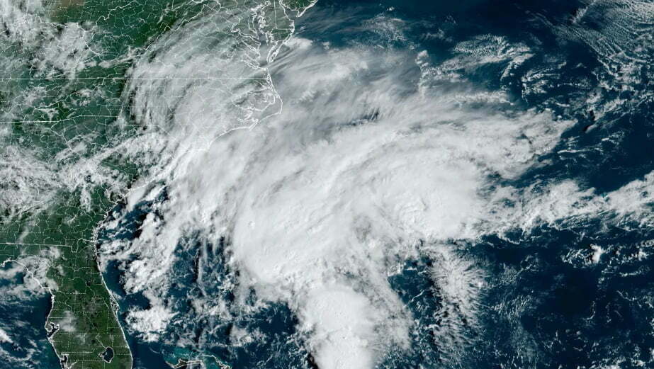
A tropical storm warning has been issued for portions of the North Carolina and mid-Atlantic coasts due to a building storm that will track near the coast until this weekend and bring strong winds, lots of rain, hazardous rip currents, and coastal flooding to places from Florida to New England.
The National Hurricane Center has designated the region of low pressure, which it is calling Potential Tropical Cyclone 16, as having 35 mph winds off the east coast of Florida. The National Hurricane Center predicted that as it gets closer to the coast of North Carolina on Friday, it will intensify into a tropical storm. It may be given the name Ophelia or Philippe, depending on the time period.
From the state line separating Maryland and Delaware to just south of Wilmington, North Carolina, a tropical storm warning was issued. Before moving into the mid-Atlantic on Saturday, tropical storm-force winds could hit North Carolina as early as Friday.
The same stretch of coastline was also under a storm surge watch, with up to 4 feet of surge likely from Surf City, North Carolina, to the Virginia Tidewater.
On Thursday, the storm began to coalesce and began to produce rain and storms over portions of Florida’s northeast coast and far southeastern Georgia. The storm’s worst will occur this weekend, but the windy conditions also increased and worsened the waters.
Gloomy weekend weather brought on by storm along the East Coast
Rain fell widely.
Rainfall will change locations into the Carolinas and Virginia on Friday as the coastal storm gets more structured. On Saturday, rain will spread hundreds of miles from its center as it moves north, soaking parts of the mid-Atlantic during the day and even New England by Saturday night.
The areas around the coast will continue to see the highest rains, but severe weather will still affect inland areas and might thwart outdoor plans.
Far eastern North Carolina is predicted to receive totals of 4 to 6 inches of rain, posing the highest risk for heavy rain and flooding.
A considerably wider area of the eastern US, from central North Carolina to New Jersey and New York, could have two to four inches of rain on Saturday through Sunday. This weekend, 1 to 2 inches of rain may fall in Pennsylvania as well as southern New England.
Powerful winds
On Friday, wind gusts of 30 to 40 mph are expected in coastal locations, with greater gusts possibly closer to the storm’s center. Parts of the Carolinas are predicted to experience the greatest winds on Friday, and the remainder of the mid-Atlantic is expected to experience them later on Friday into Saturday.
The combination of these wind gusts and the soggy ground may cause trees to fall, resulting in property damage and power outages.
Coastal dangers
The storm will stir up treacherous waves as it moves north, increasing the risk of severe rip currents along much of the East Coast. The weather service issued a high danger for rip currents for portions of the shoreline from Florida to New Jersey as the weekend approached.
As the storm travels up the coast this weekend, coastal flooding is also a possibility for parts of North Carolina that extend northward into New Jersey. On Saturday, major to moderate flooding is expected in a number of locations around Delaware Bay and in the Virginia Tidewater as a result of the storm’s powerful winds pushing water into rivers along the coast.
According to NOAA, multiple highways, homes, and businesses may be submerged in areas where significant flooding occurs.